
Burrell Lock is now open and has resumed normal operations
Boaters and visitors can once again use Burrell Lock during its regular operating schedule. Thank you for your patience while maintenance was completed.
For lock hours and additional information, visit: https://sjrwmd.info/Locks

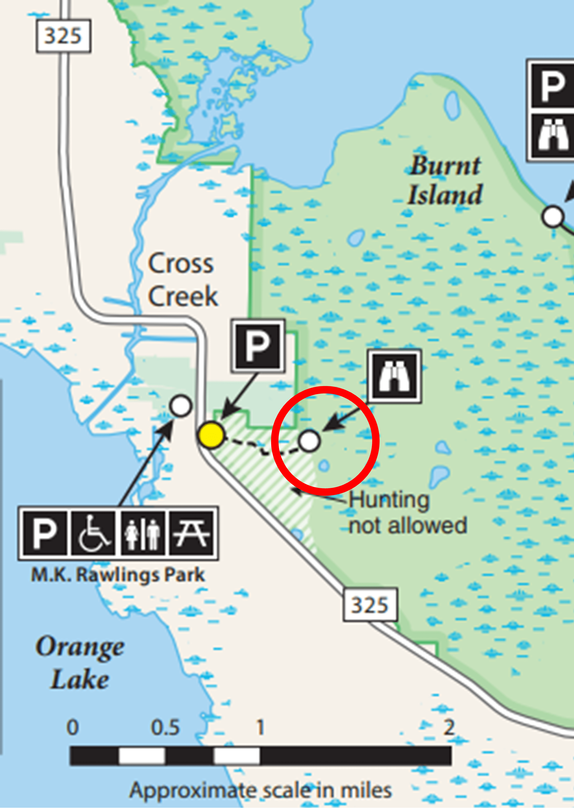
Newnans Lake Conservation Area Hatchet Creek Tract red trail closed
The Newnans Lake Conservation Area Hatchet Creek Tract’s red trail is closed until further notice due to a wildfire and suppression crews and equipment working the area. Please use caution when traveling in the area.
St. Sebastian River Preserve State Park
Structure 157 (S-157) located along Canal 54 (C-54) in St. Sebastian River Preserve State Park is now open to the public after major construction rehabilitation work to the structure. Please be aware that the downstream (east) wingwalls will remain closed off and inaccessible to the public for safety reasons.
Additional repairs will be made to the east wingwalls in the future (schedule TBD). During the future construction phase, public access to S-157, including the manatee overlook and spillway, will be closed until repairs are complete.
Please monitor this page for updates.
Lake Apopka North Shore – Conrad Road
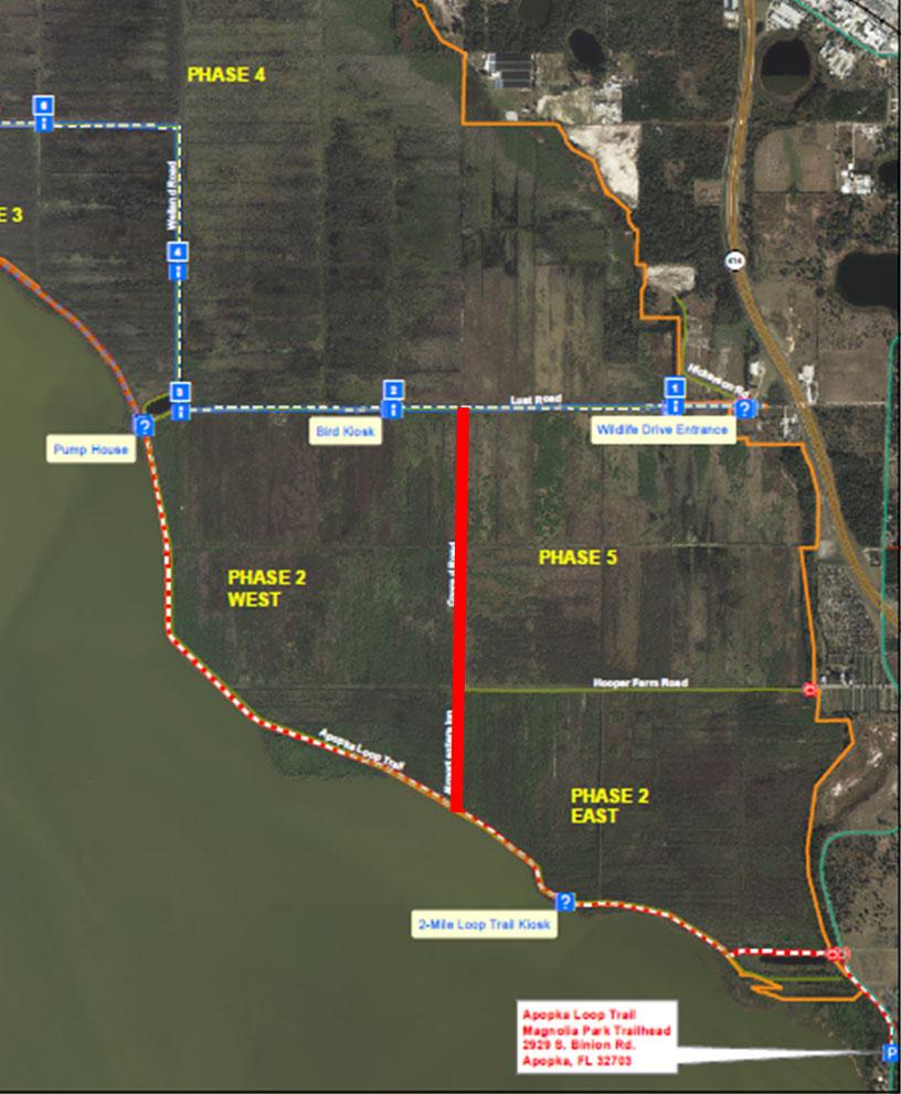 Conrad Road, between Lust Road and the Lake Apopka Loop Trail, will be closed until further notice for contract work. The Loop Trail and Lust Road will remain open.
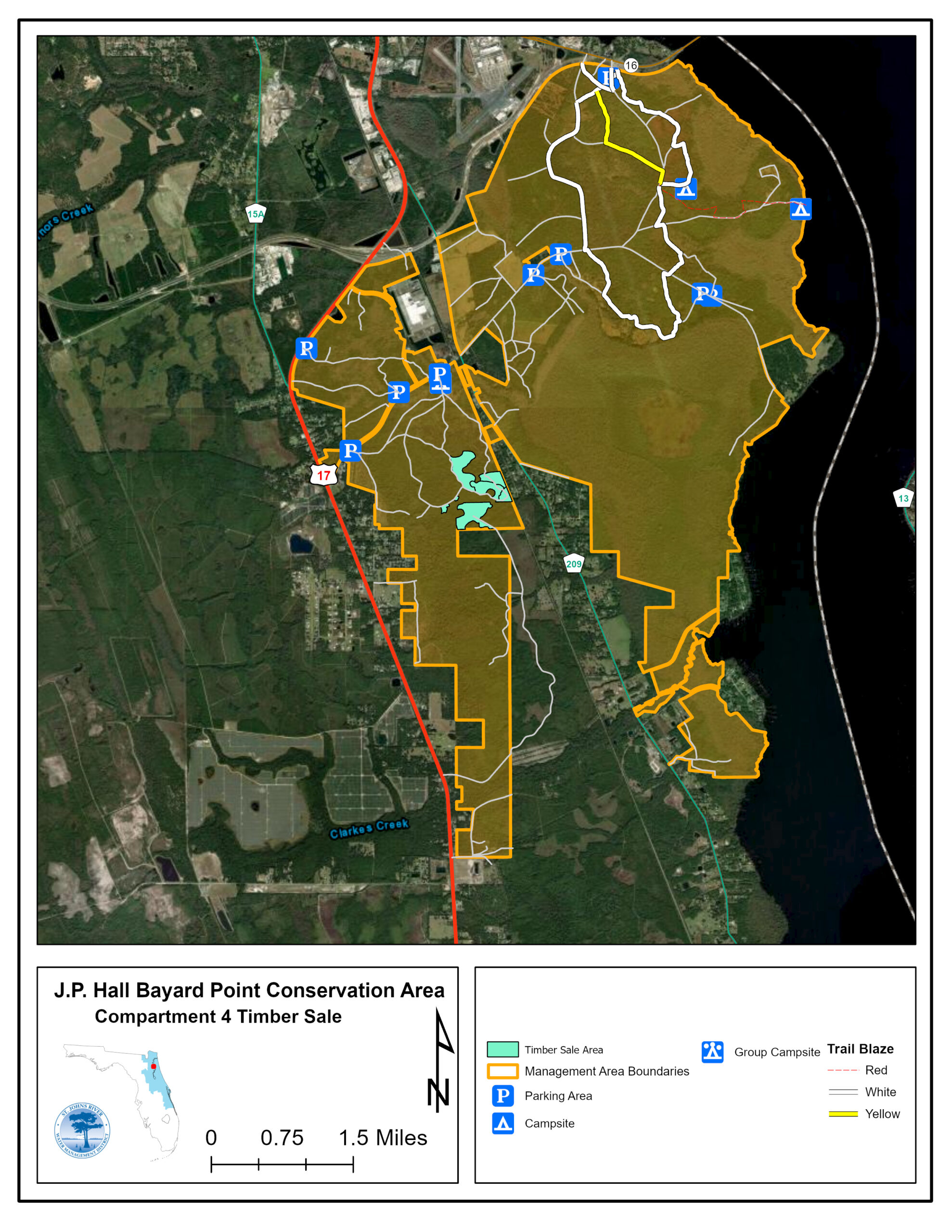
J.P. Hall Bayard Point Conservation Area
Road construction for the First Coast Expressway continues on State Road 16, making access to the J.P. Hall Bayard Point Conservation Area trailhead parking area difficult to spot. The entrance road to the parking area is 0.4 miles east of Owens Road or 1.2 miles west of Susan Drive in Clay County. Please see the Google map link on the property description web page for directions.