Update: Repairs continue as water levels decrease in some areas of Lake Apopka North Shore

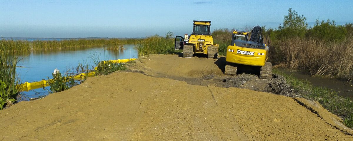
Several days of dry weather allowed significant progress on repairs to the lake-side levee, which will eventually be capped with limerock.

Several days of dry weather allowed significant progress on repairs to the lake-side levee, which will eventually be capped with limerock.
MAITLAND, Fla., Nov. 3, 2017 — Repairs are underway at the St. Johns River Water Management District’s Lake Apopka North Shore, which experienced damage due to Hurricane Irma. As water levels subside and assessments are completed, the district is continuing to provide weekly updates on the status of repairs and recreation at the Lake Apopka North Shore.
- Several days of dry weather allowed significant progress on repairs but additional work is necessary to make the area safe for public use. Several roads remain underwater.
- Initial repairs to the levee breach are complete. Additional repairs, including adding materials to stabilize the sides and top of the levee, will be completed when water levels decrease within the Lake Apopka North Shore.
- To date, 1,560 tons of material have been transported and placed on the breach to return the levee to its pre-hurricane elevation.
- Water levels on Lake Apopka decreased and are now at the regulation schedule.
- Discharge out of Lake Apopka through the Lake County Water Authority’s Nutrient Reduction Facility was temporarily reduced by half, to 150 cubic feet per second, for periodic maintenance and to maintain nutrient removal performance.
- Pumping continues from areas on the western portion of the property. As of Oct. 27, water levels in this area decreased by about 18 inches.
- Understanding that the North Shore is a popular outdoor recreation destination, the Red Trail, off County Road 448A, and the McDonald Canal Boat Ramp are open.
- To ensure public safety, and minimize potential damage to saturated roads, no other openings are planned at this point due to flooding and the continued presence of heavy equipment. The Lake Apopka Wildlife Drive and nonmotorized Lake Apopka Loop Trail remain closed. As soon as the district determines that the public can safely access an area, it will open.
For continuing updates on district operations and recreational announcements, visit the district’s website, www.sjrwmd.com. More information about lake levels is available at www.sjrwmd.com/data/hydrologic/#controlled.

